


St. Paul — Researchers are almost a month away from starting the second year of a three-year study that should help DNR wildlife managers in northeastern Minnesota get a better understanding of deer densities and, in turn, be better equipped to set regulations accordingly.
Eric Michel, a former lead researcher with the DNR, headed the project in its first year, but Michel has since taken a new job at Mississippi State University with the MSU Deer Lab. The study is now a collaborative effort between MSU and the Minnesota DNR, with MSU graduate student Parker Kreie helping to conduct the research and analyze the data.
Tyler Obermoller, who has stepped into Michel’s former role as an ungulate research scientist with the DNR, is also leading the study.
Last summer, researchers placed nearly 40 trail cameras split almost evenly across public and private land in deer permit areas 169, 176, 177, 178, 197, and 679. Those are located in Cass, Beltrami, Itasca, Hubbard, and St. Louis counties.
The study hinges on obtaining permission from private landowners, and many who were contacted with letters became willing participants. Researchers are contacting landowners again this spring in order to place cameras on different properties each year of the study.
“We didn’t have too much of an issue (getting permission),” Obermoller said. “One of the things we provide if they let us go on their land is … all the images that have something on them – deer, bears, wolves, whatever we find. We send those back to the landowner, so I think that gives them a nice incentive to cooperate with us, and it’s mutually beneficial for us both.”
MORE COVERAGE FROM OUTDOOR NEWS:
Game birds entering critical period when weather, habitat conditions dictate future hunter success
Master minnowbaits for better muskie fishing
The cameras are placed in early July and pulled in early September, before the start of the state’s archery hunting season. Unlike cameras utilized by hunters that are motion-activated, the cameras in the study take a photo every five minutes, racking up thousands of images. The program utilizes artificial intelligence to filter the photos.
Obermoller said cameras are placed randomly (not over bait, a specific food or water source, etc.) within what is considered good deer habitat. That is done in an attempt to remain unbiased and not inflate deer density estimates.
Researchers are mindful about making sure cameras have a good field of view during summer months when vegetation explodes.
“The AI quickly goes through the cameras until it identifies a deer, and then it stops and resets,” Obermoller said. “It keeps doing that over and over again and with those empties and actual signatures of deer it can create a density estimate. It’s kind of a unique method. We’re really at the beginning of this feasibility method.”

Year one results
In an email to Outdoor News, Kreie said the cameras captured 393 deer, one bear, and “additional species detected, but not counted, included hawks, songbirds, and sandhill cranes” last summer.
Kreie said the significance of the number of deer photos captured in Year 1 won’t be known until after researchers are able to compare the numbers to the final two years of the study.
“We’re being optimistic but also taking the time to determine how this method can work to get density estimates – really more importantly get trend estimates,” Obermoller said. “That’s kind of what we want to look at. Is the population decreasing? Increasing? The ultimate goal is to use this to help set deer harvest regulation limits.”
One part of the study of interest to researchers, and likely hunters, too, is what the data say about deer numbers on private land versus public land.
“We are seeing some variation in the number of images containing deer between private and public lands, with privately owned lands having slightly more images,” Kreie said of the first-year results. “However, we are still developing population estimates from the two land types and cannot make any conclusions from our 2024 data yet.”

Important research in the forest region
The northeast region of the state is an area where many hunters have sounded the alarm about dwindling deer numbers. All six DPAs in the study area are one-deer zones, with DPAs 169 and 176 being bucks-only areas last fall.
Forested regions like this are always more difficult landscapes to get accurate deer estimates on due to limited visibility from both the air and road, Obermoller said. That’s why researchers are hopeful that a study model like this that utilizes AI technology now available can help paint a clearer picture of deer numbers.
“I think the power at the end of this will be looking at the three years in conjunction and see how that lines up with some of the other model parameters that we have,” Obermoller said. “So deer harvest, our current model results, and kind of line them up and see, is it decreasing or increasing as we thought?”
The deer population model is just one metric the DNR uses to help set hunting regulations. Hunter harvest, the winter severity index, and what wildlife managers are seeing and hearing from hunters also play roles.
Minnesota features a diverse habitat landscape where deer densities are not created equal. That’s why trying to obtain more accurate population estimates, especially in specific regions, is so important to managers and hunters alike.
“That’s one of the things I’m going to try to help out with is, how do we get deer trend or density estimates all across the state, which is really difficult,” Obermoller said. “It’s a large state and costly to do all these surveys, so what we may be doing is focusing more on these populations where our managers are having difficulties setting regulations.”
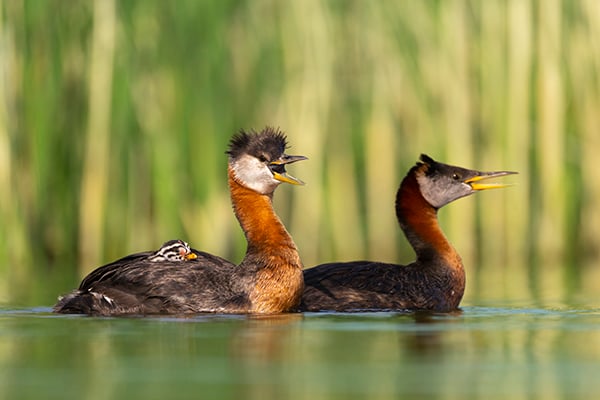
Nature Smart: Red-necked grebes
Each spring I lead photo workshops to capture images of the common loon. This iconic waterbird of the northern lakes
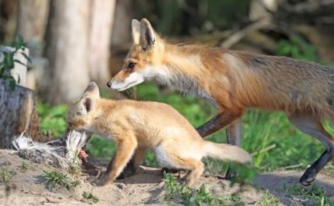
Backyard and Beyond: Kits, fawns, and nests
Scott Thiede has been keeping an eye on the fox den in his urban neighborhood, and recently caught a parent

Wisconsin Cuffs & Collars: Landowner feeding deer in Oneida County despite longtime ban
Wisconsin cuffs and collars are field reports from DNR wardens. These reports are from the June 26, 2026 edition of
