


Assessing waterfowl and their habitat can be tough work that often involves waders, binoculars, and owning a temperament that turns wading through muck into fun.
In other cases, it requires an airplane flying at more than 100 mph high above the Earth, with those aboard trying to get a clear view of life on the ground. Now, though, a new tool – drones – is changing the waterfowl biologist’s world. Aerial drones are playing a key role in examining Wisconsin watersheds and the birds that call them home.
 This content is restricted to subscribers of OutdoorNews.com. If you are already an OutdoorNews.com subscriber, you can
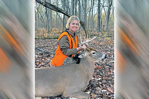
New York Outdoor News’ 2026 Person of the Year has talent she uses to strengthen the outdoors
Debbie Brosen’s talent as an artist is evident in the work she’s become renowned for, especially painting wildlife scenes on
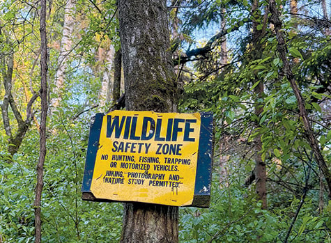
Patrick Durkin: Landscapes endure despite varied users, abusers
While hunting turkeys on public lands not far from Eau Claire, Wis., in mid-May, I noticed a unique property boundary
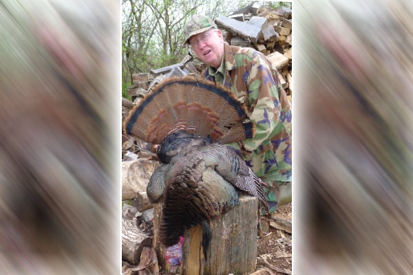
A plan that came together on what turned out to be my final turkey hunt
Sooner or later, it was bound to happen – my final successful spring turkey hunt. That final gobbler hit the
