




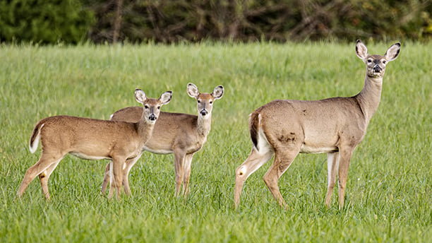
Ask a room full of deer hunters how many deer live in their county and you’ll likely get a dozen different answers. Some will insist the woods are overrun with deer. Others will argue the herd has collapsed. Both groups may have hunted the same property.
The truth is that estimating white-tailed deer density is one of the most difficult tasks in wildlife management. Deer are mobile, mostly nocturnal, and spend much of their lives hidden in forests, swamps, crop fields, and suburban cover. Unlike cattle in a pasture, they cannot simply be counted.
Yet state wildlife agencies must estimate deer abundance if they hope to manage harvests, evaluate habitat conditions, monitor disease risks, and balance deer populations with public expectations. Over the years biologists have developed a toolbox of techniques, each with strengths and weaknesses.
Harvest-based population models
The most common approach used by state agencies relies on deer harvest data.
Hunters collectively remove thousands of deer each year, creating a large and relatively inexpensive source of information. Biologists combine harvest totals with estimates of hunter effort, survival rates, reproduction, and age structure to model population size. Along with Illinois, Michigan, Wisconsin, Pennsylvania, and many other states depend heavily on these statistical models.
The advantages are obvious. Harvest data are collected every year over large geographic areas and can reveal population trends over time. The downside is that harvest numbers do not always mirror deer abundance. Weather, hunter participation, regulations, access, and disease concerns can all influence harvest levels independent of population size.
For that reason, harvest models work best when supplemented by other population-monitoring techniques.
MORE WHITETAIL COVERAGE FROM OUTDOOR NEWS:
Video: Easy steps to finding great whitetail setups
Silent entry and close encounters: Kayak tactics to help you kill more deer
Eric Morken: Gear that stood out from the 2025 hunting season
Aerial surveys
When winter conditions cooperate, biologists sometimes count deer from aircraft.
Helicopters and fixed-wing aircraft can be effective in open habitats, especially when snow cover provides contrast between deer and the surrounding landscape. In parts of the West, aerial surveys remain a cornerstone of deer and elk management.
In heavily forested regions of the Midwest and Northeast, however, visibility becomes a major limitation. Even when snow is present, tree canopies can conceal large numbers of animals.
Aerial surveys can provide useful estimates but are often expensive and weather-dependent.
Spotlight surveys
For decades, wildlife agencies conducted nighttime spotlight surveys.
Observers drive predetermined routes after dark and count deer illuminated by spotlights. By repeating surveys over time, managers can track trends in local populations.
Spotlight surveys are relatively inexpensive and easy to conduct. However, they assume deer visibility remains consistent from year to year. Changes in crop cover, weather, observer experience, or deer behavior can influence counts. As a result, spotlight surveys are generally considered better indicators of trends than precise estimates of density.
Pellet-group counts
Perhaps the least glamorous method involves counting deer droppings. Biologists establish sample plots and count pellet groups accumulated over a known period. By combining those counts with estimates of deer defecation rates, they can estimate deer abundance.
Pellet counts are especially useful in forested habitats where direct observation is difficult.
The approach has drawbacks. Rainfall, snowmelt, decomposition, and observer error can affect results. Nevertheless, pellet surveys remain a valuable low-cost tool for monitoring deer populations.
Camera-based surveys
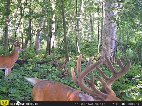
Trail cameras have revolutionized deer population estimation. Modern camera surveys often place cameras across a property or management unit and photograph deer over a predetermined period. Statistical models then use those photographs to estimate population density.
One common approach identifies individual bucks by their unique antler characteristics. Another uses sophisticated spatial capture-recapture models that estimate density based on where and how frequently deer are photographed.
Camera surveys can produce remarkably accurate estimates, particularly when sufficient cameras are deployed. Their growing popularity reflects declining equipment costs and advances in analytical software. Many private landowners now conduct camera-based surveys that rival professional wildlife studies.
Distance sampling
Distance sampling involves systematically observing deer along transects and recording how far each animal is from the observer. The fundamental principle is simple: animals farther away are less likely to be detected. Statistical methods account for this decline in detectability and estimate population density.
Distance sampling can be conducted from roads, walking routes, or aircraft. It is widely used in wildlife research but requires careful design and trained observers.
Mark-recapture techniques
Among the most scientifically rigorous methods are mark-recapture studies.
Researchers capture deer, mark them with ear tags, radio collars, or other identifiers, and later determine how many marked animals appear in subsequent samples. If many marked animals are observed again, the population is probably small. If few are observed again, the population is likely larger.
Mark-recapture methods can produce highly accurate density estimates but are labor-intensive, expensive, and generally reserved for research projects rather than statewide monitoring.
Emerging technologies
Technology continues to expand the possibilities.
Thermal-imaging drones can detect deer hidden in vegetation. Artificial intelligence can automatically identify and count animals from camera images. GPS-collar studies provide unprecedented insights into deer movement and survival. While these technologies are promising, most remain too costly or labor-intensive for broad application across entire states.
No perfect method
The public often assumes wildlife agencies know exactly how many deer occupy a county or management unit. In reality, deer density estimates are just that – estimates.
Every method involves assumptions and uncertainty. The best population assessments usually combine multiple techniques rather than relying on a single survey. For hunters, that uncertainty can be frustrating. For biologists, it is simply part of managing a wild animal that evolved to avoid detection.
The next time someone claims there are exactly 12, 20, or 40 deer per square mile in a particular area, it is worth remembering that those numbers are not direct counts. They are educated estimates derived from a variety of scientific methods, each attempting to count an animal that spends much of its life behaving like a ghost.
Even after a century of modern wildlife science, accurately counting them is still one of conservation’s greatest challenges
A quick chat with Jim and Will Pattiz, brothers behind morethanjustparks.com
Outdoor News has monitored the website Morethanjustparks.com with increasing frequency for its one-stop shopping content on America’s most important public
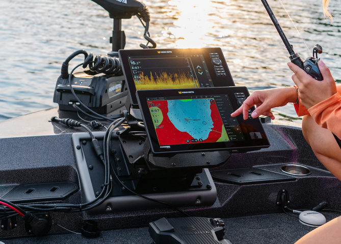
Minn Kota introduces one seamless fishing system powered with Humminbird Imaging
On Oct. 6, Minn Kota introduced the most significant expansion in its history with a new, seamless fishing system, powered

French tip: muskies in summer, slabs during winter on this southeast Minnesota water
Muskie anglers have a limited number of options in the southern part of the state; French Lake near Faribault is
